



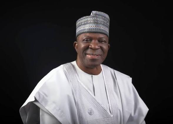
The Federal Government is expanding the use of technology in Nigeria’s border management, with drones, satellite imagery and other surveillance tools being used to gather information from difficult-to-access areas.
Director-General of the National Boundary Commission (NBC), Adamu Adaji, disclosed this in an exclusive interview with our correspondent in Abuja.
Adaji said unmanned aerial vehicles could help authorities obtain detailed images and other information from remote border corridors where deploying personnel may be difficult.
He said drone technology could provide high-resolution imagery that would assist with planning, monitoring and the management of Nigeria’s international boundaries.
According to him, aerial systems can give authorities access to information from areas that are difficult or impossible to reach quickly on foot or by conventional patrols.
“If properly deployed, they can be very helpful in providing the information and data required for the management of these boundaries,” Adaji said.
Satellite technology to support border monitoring
The NBC director-general said satellite equipment could complement drone operations by providing information covering much larger areas.
Such data, he explained, could help authorities understand developments along border corridors, improve planning and respond more effectively to emerging problems.
He also called for wider use of surveillance cameras and other information-gathering systems as part of a broader technology-driven approach to border management.
The NBC’s statutory responsibilities include defining and delimiting Nigeria’s internal and international boundaries, monitoring relations with neighbouring countries and promoting cross-border cooperation. (National Boundary Commission)
Nigeria’s borders present a difficult surveillance challenge
Nigeria shares international land and river boundaries with Benin, Niger, Cameroon and Chad, while its maritime boundaries extend into the Gulf of Guinea. (National Boundary Commission)
The scale and terrain of some border areas make continuous physical monitoring difficult.
Adaji said technology could help bridge some of those gaps by providing information from locations where security and boundary personnel cannot easily maintain a permanent presence.
The commission’s international-boundary department is responsible for supervising pillar identification and construction, monitoring relations with neighbouring countries and supporting cross-border cooperation. (National Boundary Commission)
Technology is not a substitute for cooperation
Adaji cautioned that drones and other surveillance equipment would not, on their own, resolve Nigeria’s border-management challenges.
He said effective border management required cooperation among government agencies and neighbouring countries.
That approach is consistent with the NBC’s existing multi-agency structure. The commission works with institutions including the Ministry of Defence, Ministry of Interior, Nigeria Immigration Service, Nigeria Customs Service, Nigeria Police Force, National Intelligence Agency and other agencies involved in border management and security. (National Boundary Commission)
The NBC also engages organisations such as ECOWAS, the African Union and the United Nations on boundary determination and cross-border cooperation. (National Boundary Commission)
Border communities remain crucial
Adaji also highlighted the role of people living in communities close to Nigeria’s international boundaries.
He said residents could provide authorities with valuable information because people entering the country through border corridors often pass through or interact with local communities.
The NBC chief called for better infrastructure and government support for border communities, saying stronger links between residents and authorities could encourage people to report suspicious activity.
The commission’s own mandate places emphasis on border communities, good neighbourliness and trans-border cooperation. Its stated vision is to make boundaries easily identifiable while promoting peaceful relations and cooperation among border populations. (National Boundary Commission)
Nigeria already has a broader digital border strategy
The move towards technology-assisted border management predates the latest comments from the NBC.
The Federal Ministry of Interior said in 2025 that Phase One of Nigeria’s e-Border Surveillance System had been completed, with plans to extend real-time monitoring across the country’s borders. The ministry also reported work on digital landing and exit cards, e-Visa services and systems for integrating passenger and security information. (Ministry of Interior)
In 2026, the ministry again said the Nigeria Immigration Service had been strengthening border governance through technological innovations, including automated e-gate systems at airports. (Ministry of Interior)
Those initiatives indicate that the government’s technology strategy extends beyond aerial surveillance to immigration processing, passenger information and digital border controls.
Mapping and boundary definition
For the NBC, technology also has an important role beyond security.
The commission’s primary mandate is to define, delimit and determine Nigeria’s internal, international and maritime boundaries. It also conducts investigations, supervises boundary demarcation and works with neighbouring countries on international-boundary issues. (National Boundary Commission)
Accurate imagery and geospatial information can therefore support both boundary administration and security agencies operating in border areas.
The need for accurate boundary information has been highlighted in previous NBC work. In one case involving the Federal Capital Territory and Niger State, the commission said boundary pillars were too far apart, creating uncertainty over the precise alignment and contributing to competing claims of encroachment. (National Boundary Commission)
Nigeria’s borders remain a work in progress
Physical demarcation is also continuing along some international frontiers.
The NBC reported in 2026 that technical experts from Nigeria and Benin had held a meeting on the delimitation and demarcation of their common international boundary. (National Boundary Commission)
The commission has also been involved in the lengthy Nigeria-Cameroon demarcation process. An earlier NBC update recorded 1,344 international boundary pillars constructed along the Nigeria-Cameroon boundary and identified additional pillars still required at the time. (National Boundary Commission)
These activities demonstrate why geospatial information, field surveys, satellite imagery and other technical tools can be important to boundary administration.
Cross-border cooperation remains part of the strategy
Nigeria’s border policy is not limited to surveillance.
The country ratified the African Union Convention on Cross-Border Cooperation, known as the Niamey Convention, in October 2023. The NBC said the convention could support integrated border management, cross-border cooperation and efforts against terrorism and other transnational crimes. (National Boundary Commission)
Adaji similarly said technology should operate alongside cooperation with neighbouring countries and coordination among Nigerian agencies.
For the Federal Government, the emerging approach combines physical boundary demarcation, surveillance technology, intelligence gathering and cooperation with communities and neighbouring states.
The objective is to obtain better information about what is happening along Nigeria’s extensive borders while ensuring that agencies responsible for security and territorial management can act on that information.